Finger Lakes Trail
Bowman Creek
Section
![]()
| CNY Hiking HOME PAGE | Finger Lakes Trail | FLT Central Section | Hiking in Chenango County |
|
Hiking in Chenango County Finger Lakes Trail Bowman Creek Section
|

This short 3.4 mile section of the Finger Lakes Trail begins off of French Road and ends at the FLT crossing of NY 12 near the Chenango River. This section is located in Chenango County, southwest of Oxford, NY and is a very scenic section of the Finger Lakes Trail. This stretch of the FLT is featured on map M25 from the FLTC.
This whole section is on private property and its due to the generosity of the landowners that we are able to hike through their land on the Finger Lakes Trail. Please be respectful and stay on the trail. This section can be hard to follow at times, be sure you are looking for the white blazes.
The start of this section sees the trail ascend up a hill before descending slowly toward Buckley Hollow Rd. After crossing the road (good parking here) there is the first of four stiles to cross. The trail first follows near a small stream with numerous small waterfalls. There are many reminders of past walls and foundations from years ago along the trail.
The trail turns with Bowman Creek and soon you'll see a couple of waterfalls down below. The trail mainly runs above the creek. There is the remains of an old 1875 mill that can "somewhat" be seen from along the trail (watch blazes closely because the trail can get tricky here). After crossing the last stile, there are great views of Bowman Creek below and a trail register.
The trail enters a field with surprising views of the surrounding hills. The trail follows along side of the fields and leaves to eventually makes it's way to NY 12 and the Chenango River. Be careful of the "gravel pit" that is next to the trail.
Look below for a few pictures, a video, map and trail description of this section of the Finger Lakes Trail.
Directions: From Oxford, NY take NY 12 south then a right on County Route 3. Pass through the small hamlet of Tyner and turn left on Winner Road. Take Winner Road to its end and turn right on French Road. The trail goes into the woods near the corner of Hattie Clark Rd and Fred Wilcox Road. The GPS coordinates for the trailhead on French Road is N42 24.902 W75 40.416 and the GPS coordinates for the trailhead on Buckley Hollow Road are N42 24.002 W75 39.720 for those who have a GPS devise.
Trail at Buckley Hollow Road
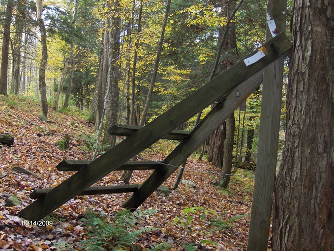
Stile along the trail
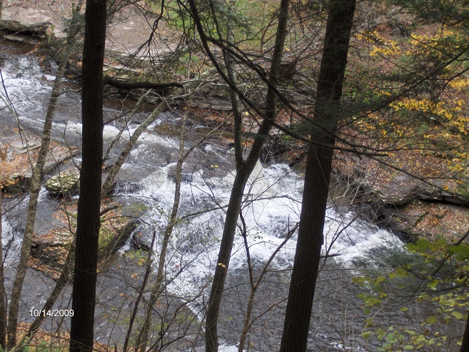
Waterfalls on Bowman Creek
Mile Elevation Trail Description (follow white blazes) 0.0 1549 feet Trail turns right off French Road and enters woods. Parking 0.1 mile to the east.
0.3 1624 feet Top of hill, trail begins long descent toward Buckley Hollow.
1.15 1409 feet Trail turns left.
1.4 1355 feet Trail turns right.
1.65 1224 feet Trail turns left toward Buckley Hollow Road.
1.75 1193 feet Cross Buckley Hollow Road. Parking. Cross small stream and stile.
1.85 1189 feet Trail leaves cow pasture and descends next to small stream with numerous small waterfalls on your left.
1.95 1112 feet Trail is now following Bowman Creek (below on your left).
2.1 1094 feet Waterfall on your left along Bowman Creek.
2.85 999 feet Trail crosses old wall.
2.9 998 feet Ruins of old 1875 mill is 100 feet to the north.
3.05 1046 feet Cross last stile. Great views of Bowman Creek below. Trail register. Enter field and more views.
3.35 961 feet Reach NY 12 and the end of this section. Parking on west side of NY 12 and more parking at the South Oxford Bridge. The Finger Lakes Trail crosses the Chenango River at this bridge. For a continuation see the Bear Brook section.

| CNY Hiking HOME PAGE | Finger Lakes Trail | FLT Central Section | Hiking in Chenango County |