| CNY Hiking HOME PAGE | NCT in Central New York | Hiking in Central New York | Hiking in Oneida County | Old Erie Canal State Park |
|
North Country
Trail New York State Parks Old Erie Canal State Historic Park Lock 21 to Erie Canal Village
|
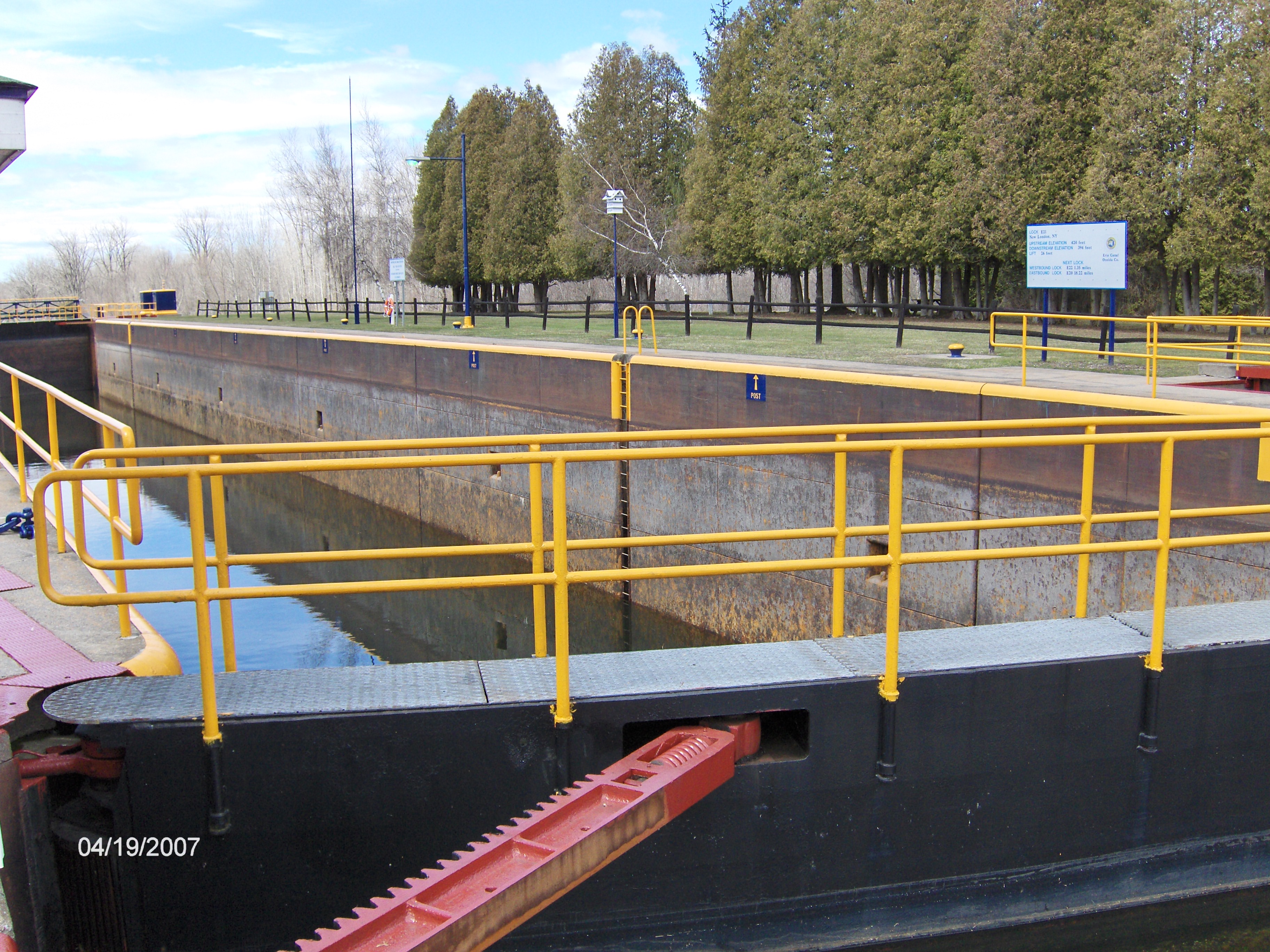
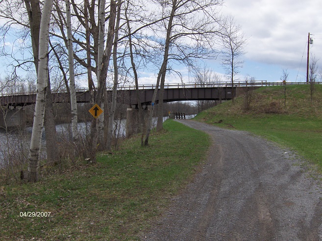
This section of the trail begins following the "new" Erie Canal towpath at Lock 21. The trail crosses over one of the locks gates to cross the canal. There are some picnic tables at the lock. There are plans to create campsites near Lock 21 for thru hikers and boaters. The plan is to have this completed by the fall of 2010. The trail goes under NY 46 before traveling next to Circle Road. There is a large parking area at Circle Road.
The trail veers left away from the new canal toward the Old Erie Canal Towpath. The trail crosses Seifert Road and in 1.4 miles the trail reaches a large parking area just west of the former Erie Canal Village.
The trail now is open and next to NY 46 as it approaches Old Erie Canal Village. At the canal bridge, the trail ends for this section. The trail in the future will run near NY 46 through Rome, NY and follow near the Old Black River Canal Towpath along NY 46 past Delta Lake State Park up to just south Pixey Falls State Park. This is where the trail currently starts up again off road (as of March 2013).
North Country Trail crosses this gate at Lock 21
North Country Trail going under the NY 46 bridge
Mileage Description (mileage continued from Canastota) 13.3 Lock 21 on Erie Canal. Cross canal along the lock gates.
14.7 Cross under NY 46 bridge.
15.1 Parking area off Circle Road
17.1 Zingerline Road on left
17.7 Cross Seifert Road
19.1 Parking area off NY 46/49
19.5 Reach canal bridge for the former Erie Canal Village. Currently the North Country Trail ends here and begins again along NY 46 just south of Pixley Falls State Park. The NCT will enter Rome and pass Fort Stanwix, then follow the old Black River Canal up to Pixley Falls State Park. This section has not been completed. Look for updates.