Our 2010 Hikes - April 1 - First Hike
Irvin Loopwith side trip to Cristina Creek Falls
![]()
| CNY Hiking HOME PAGE | Our 2010 Hikes | Hiking in Central New York | Irvin Loop |
|
Our 2010 Hikes - April 1 - First Hike Irvin Loopwith side trip to Cristina Creek Falls
|

Date: April 1, 2010
Mileage hiked: 1.9 miles includes side trips to camping spot & waterfalls
Location: off Daisy Hollow Road near Virgil, NY
Trailhead: Along the west side of Daisy Hollow Road
Trailhead Coordinates: N42 27.792 W76 13.944
Name of Trail: Finger Lakes Trail, Irvin Trail, Spanish Loop Trail, Cristina Creek Falls Trail
Hike Difficulty: Easy to Moderate.
Elevation Gain: 442 feet
Trail Conditions: Well marked, easy to follow, some wet spots.
Features: Pleasant walk, power line view, scenic streams, small waterfalls and a camping area.
Links: Irvin Trail Loop
On Thursday we decided to head down and hike the Irvin Loop near Dryden and Virgil, NY. It was a great day for hiking. The trail was at times wet and muddy, however that was expected since it is still early spring or as hikers call it, "Mud Season". This is a very popular hike and the trails are completely located on private property. The waterfalls and cascades of Cristina Creek, while not spectacular are a nice side trip for a visit (when there is water).
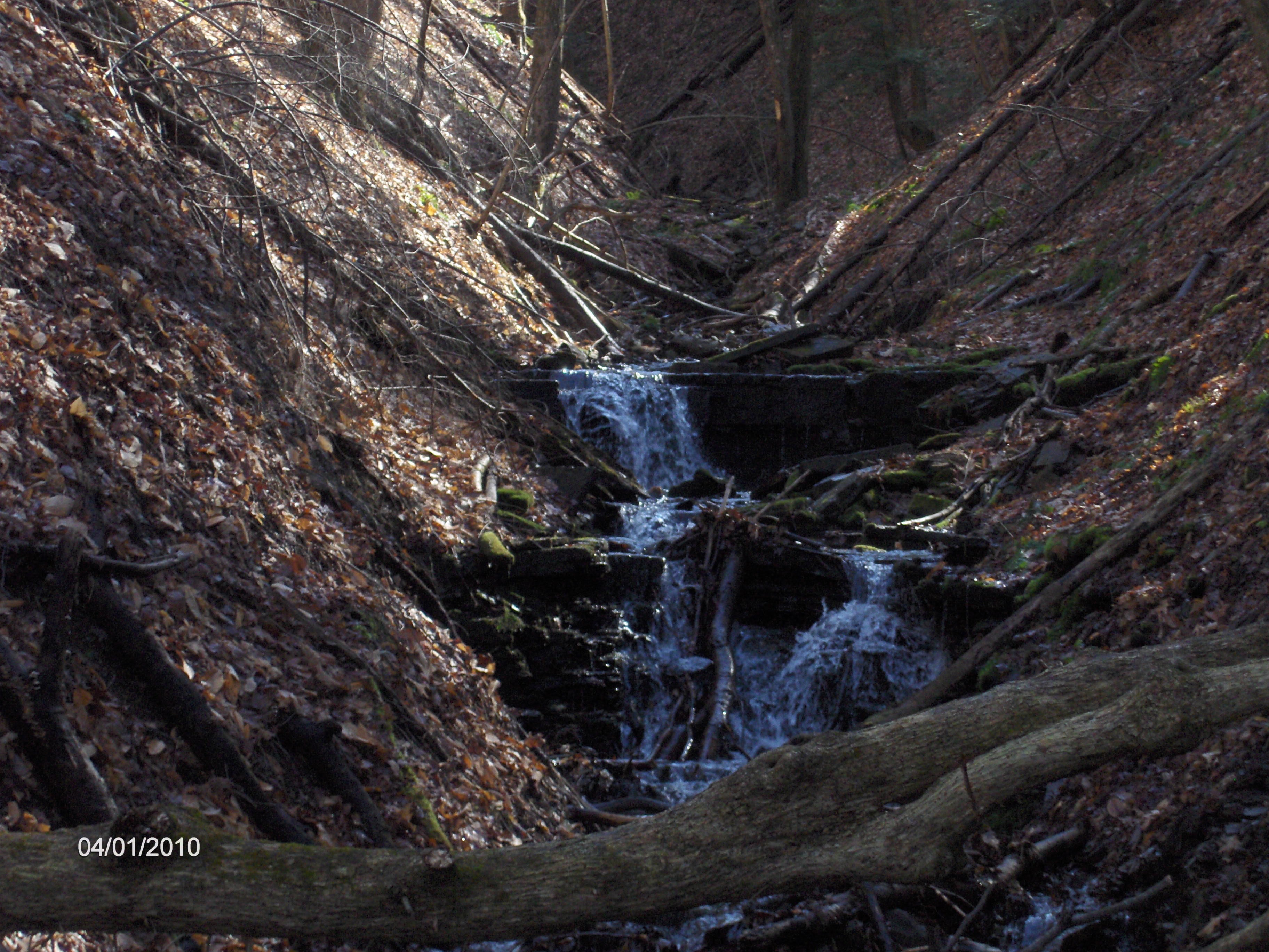
Upper Cristina Creek Falls
We started from the main trailhead on Daisy Hollow Road and hiked a short distance along the Finger Lakes Trail / North Country Trail to the bank of Rowland Creek. This is where the Spanish Loop Trail begins at the triple orange blazes. Follow the orange blazes back toward Daisy Hollow Road and cross the road at 0.1 miles. Begin to ascend and soon reach the triple blue blaze junction of the Irvin Trail.
Turn right onto the Irvin Trail. Soon you'll reach Cristina Creek at 0.25 miles. The trail follows and then crosses the creek at the junction of Eric's Path. Take this yellow blaze trail to a small camping area with a fire ring and bench. A few feet further up the trail to a couple of green chairs with a view of the lower falls of Cristina Creek. Return to the blue blazed Irvin Trail.
The Irvin Trail crosses the creek again and reaches the yellow blazed junction of the Cristina Creek Falls Trail at 0.45 miles. Follow this short 0.1 mile pleasant trail to a view point of the Upper Falls of Cristina Creek. Return back to the Irvin Trail and begin your main ascent of the hike. The ascent follows numerous switchbacks that bring you close to the edge of the gorge with the sounds of Cristina Creek below you.
Trail register at the Irvin Trail & Spanish Loop Trail crossing
At 0.8 miles you reach a trail register and cross the orange blazed Spanish Loop Trail. Continue on the blue blazed Irvin Trail. At 0.9 miles reach power lines with a nice view of Rowland Ridge across the way (see panorama above). The trail returns back into the woods and at 1.0 miles you reach the highest point of this hike at 1722 feet. At 1.1 miles you'll reach the end of the Irvin Trail at the junction of the Spanish Loop Trail. Turn right and follow the orange blazed Spanish Loop Trail. Soon you'll cross a gas pipeline ROW and cross under power lines before entering back into the woods.
At 1.35 miles reach the trail register and the Irvin Trail. Continue your descent on the orange blazed Spanish Loop Trail. At 1.8 miles you'll cross Daisy Hollow Road and you should see your vehicle up the road. Shortly you'll reach Rowland Creek and the Finger Lakes Trail / North Country Trail for your last few feet to the trailhead on your right.
We have included a map below of this great hike. Go to our Irvin Trail Loop link for more info. We are working on our video of this hike. You can help support this hiking trail by purchasing official maps & guides from the Finger Lakes Trail Conference website. They have a great large map with description of the Spanish Loop Trail, Irvin Loop, Eric's Path and the Cristina Creek Falls Trail.
One lesson we'd like to pass along to all our fellow hikers. Our secure digital card for my camera went bad as we hiked. I always carry a second card and replaced the card, but lost the photos we took at the campsite and lower falls. Always carry a back up digital card for your camera!!!
Directions: From Dryden take NY 392 East & right on W Meeting House Rd, then right on Daisy Hollow Rd.
From Virgil take NY 392 West then left on W Meeting House Rd, then right on Daisy Hollow Rd.
There is parking along the west side of the road at the FLT sign.

| CNY Hiking HOME PAGE | Our 2010 Hikes | Irvin Loop |
contact CNY HIKING by email at contact@cnyhiking.com
(c) 2006-today CNY Hiking - All rights reserved. Any use of information from this site without permission is strictly forbidden.