Hi Tor WMA to
Italy Hill State Forest
![]()
| Bristol Hills Trail | Ontario County Park to Naples | Naples to Hi Tor WMA | Italy Hill SF to Wagon Wheel | Wagon Wheel to Urbana SF | Urbana SF to FLT/NCT JCT |
|
Bristol Hills
Trail Hi Tor WMA to Italy Hill State Forest
|
The Bristol Hills Trail is a branch trail of the 900+ mile Finger Lakes Trail System. The trail winds over 50 miles from its northern terminus at Ontario County Park, through Naples, NY and on to it's southern terminus at the main Finger Lakes/North Country Trail near Mitchellsville, NY. The trail is marked with orange blazes and passes through numerous state forest and Hi Tor WMA. It is a great long weekend backpacking hike for those who have a shuttle.
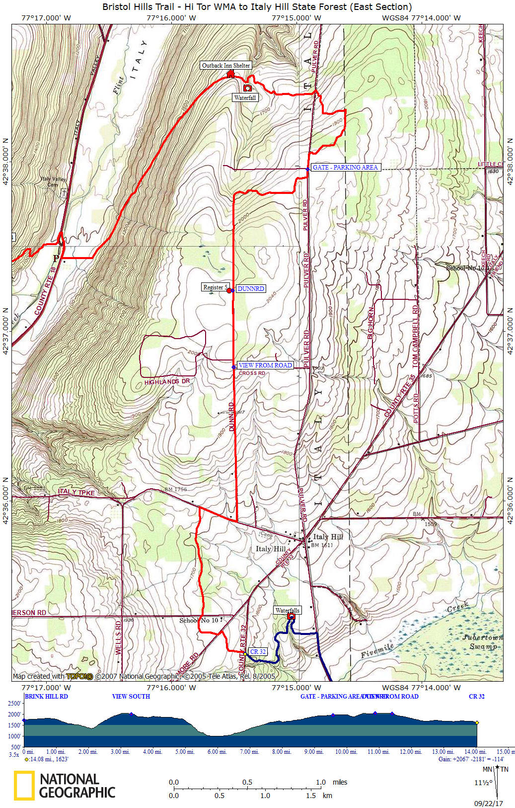
This 14.1 mile section features Italy Hill State Forest, the Outback Inn Shelter and a couple of waterfalls. There are a couple of road walks as well as some heavy duty climbing during this challenging stretch of the Bristol Hills Trail. Look below for a few pictures, a couple of maps and description of this section of the BHT.
You can help support this trail by purchasing official Bristol Hills Trail maps from the Finger Lakes Trail Conference or volunteer! We recommend that you check the latest trail conditions from the Finger Lakes Trail Conference website under the "trail conditions" link, as there can be changes that we are unaware of.
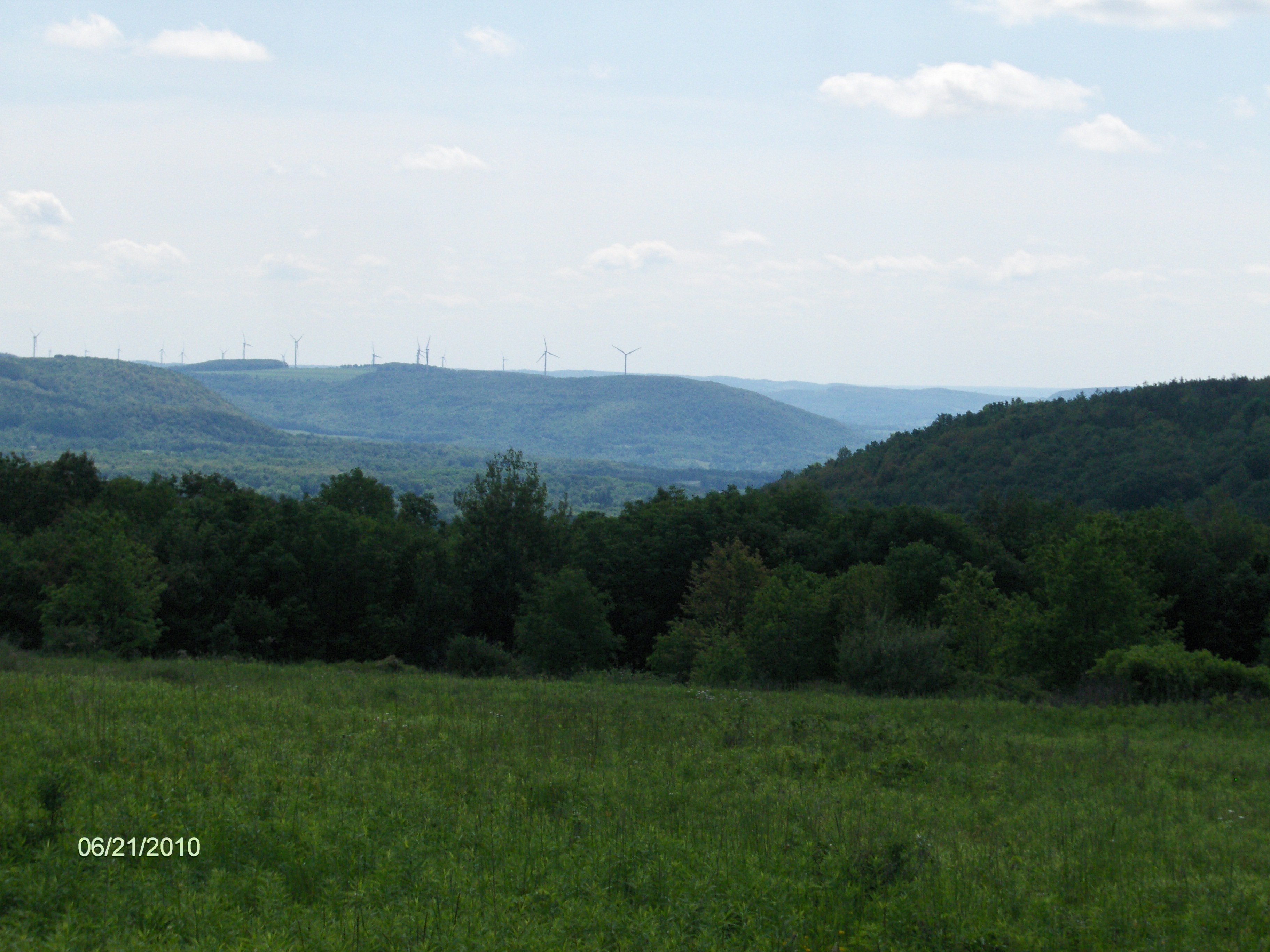
Windmills on the surrounding hills in the distance
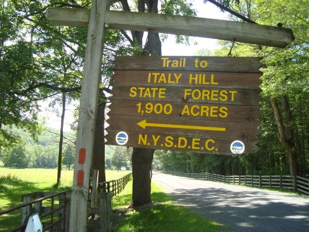
DEC sign for Italy Hill State Forest
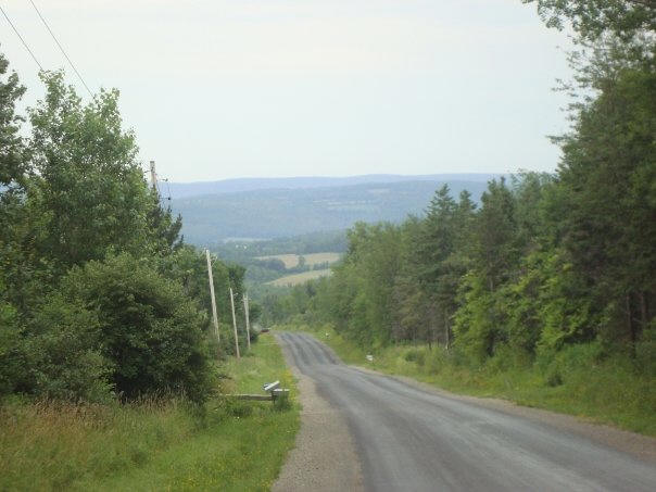
Dunn Road
Mile Elevation Description of Trail from north to south 0.0 1738 feet Brink Hill Rd. Some shoulder parking. GPS N42 37.301 W77 19.693 Follow road. 1.35 1574 feet Turn left on Bassett Road. Still following roads. 2.1 1340 feet Turn left on seasonal dirt Woodhill Road. 3.1 2045 feet Right off Woodhill Road.
3.3 2023 feet Views to your right.
4.9 1803 feet Beginning of steep descent toward Italy Valley Rd.
6.0 993 feet Turn right on Italy Valley Road. Parking. GPS N42 37.582 W77 16.889
6.2 1007 feet Trail leaves road on left. Shoulder parking. GPS N42 37.433 W77 16.892
6.4 1039 feet Trail turns left on old logging road and begins long gradual ascent up hill. Entering Italy Hill State Forest
7.95 1692 feet Outback Inn Shelter.
8.1 1629 feet View of waterfall.
8.7 1779 feet Cross abandoned section of Pulver Road.
9.5 1946 feet Left on abandoned section of Pulver Road.
9.6 1961 feet Gate. Parking area. Driveable section of Pulver Road. GPS N42 37.955 W77 14.912
9.7 1969 feet Trail turns right off Pulver Road.
10.3 1889 feet Trail turns left on abandoned section of Dunn Road.
10.6 2038 feet pass gate
10.9 2043 feet Trail Register. Parking. Driveable section of Dunn road. Follow Dunn Road. GPS N42 37.240 W77 15.513
11.45 2017 feet View from road. 12.5 1674 feet Turn right on County Route 34.
12.8 1728 feet Trail turns left off County Route 34. Some shoulder parking. GPS N42 35.961 W77 15.772
13.55 1692 feet Cross Emerson Road.
13.8 1686 feet Left on Wetmore Rd, then in 50 yards turn right off road.
14.1 1622 feet Reach County Route 32 and the end of this section. Shoulder parking. GPS N42 35.098 W77 15.412
For a continuation see Italy Hill State Forest to CR 74

| Finger Lakes Trail | North Country Trail in WNY | |
| Hi Tor WMA | Italy Hill State Forest | Urbana State Forest |
| Pigtail Hollow State Forest | Bristol Hills Trail | Ontario County Park |