Whiskey Bridge
to Dalton
![]()
| CNY Hiking HOME PAGE | Finger Lakes Trail | NCT in Western New York | North Country Trail in NY |
|
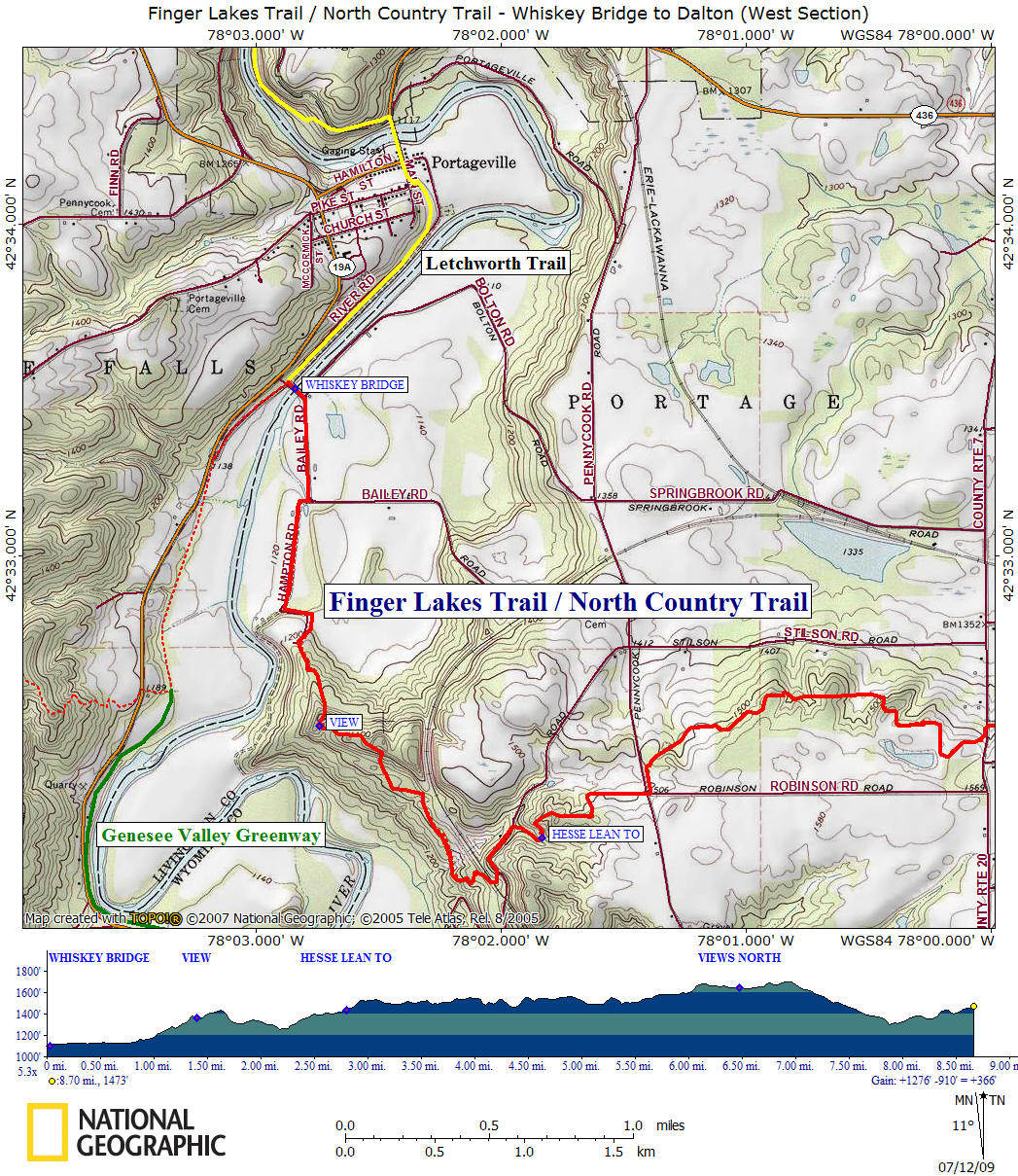
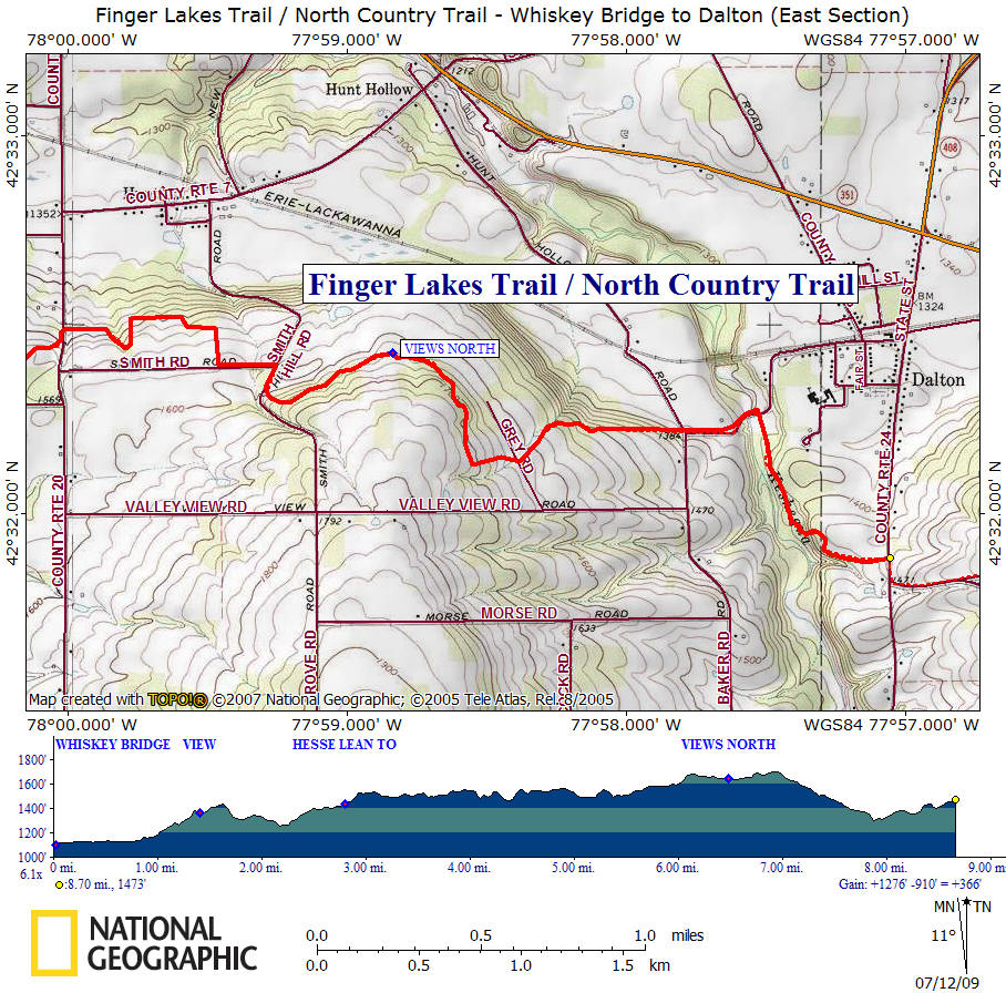
North Country Trail Whiskey Bridge to Dalton
|
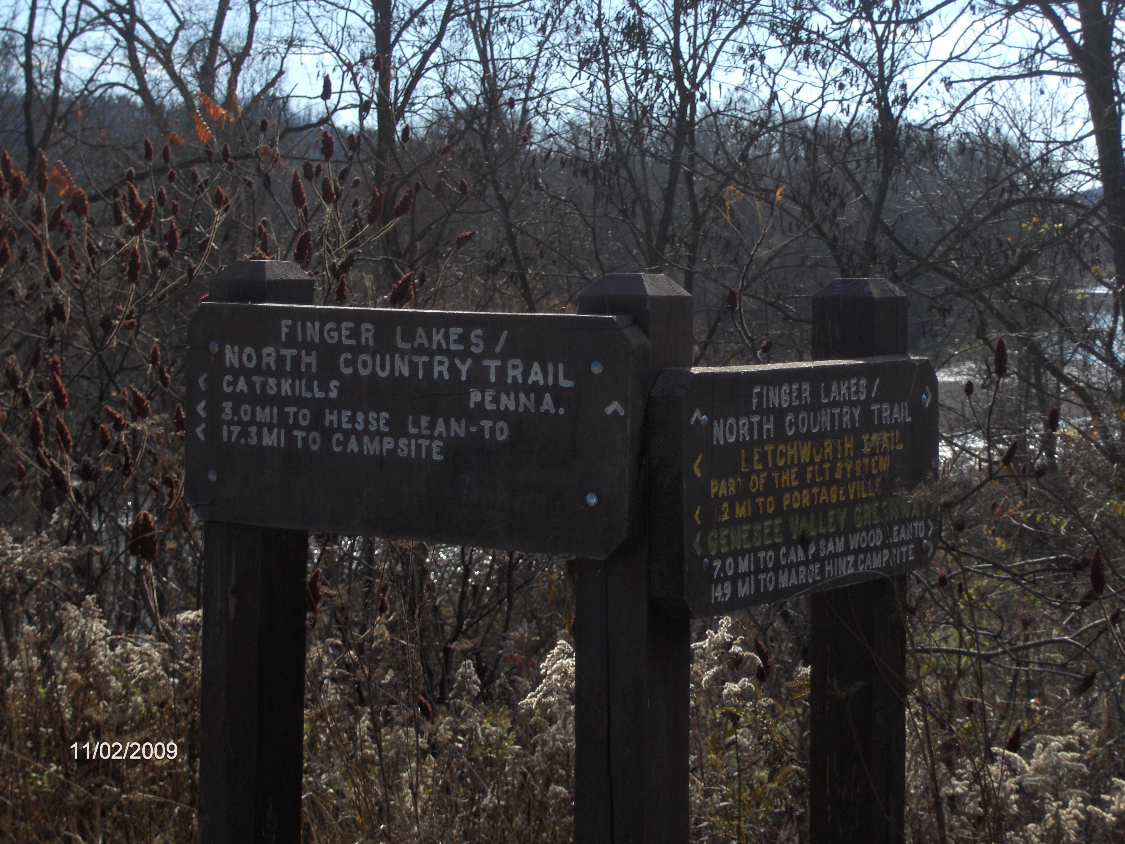
This 8.7 mile section of the North Country trail begins as the trail crosses the Whiskey Bridge over the Genesee River. The orange blazed Letchworth Trail goes north at the Whiskey Bridge. The NCT coincides with the white blazed Finger Lakes Trail along this section of the trail. The trail follows Bailey Road briefly prior to turning right onto a private drive (Hampton Road) as the trail ascends away from the Genesee River. After the trail leaves the private drive, it follows close to the unstable sandy cliffs above the river. There are some views.
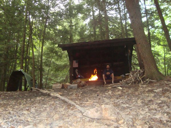
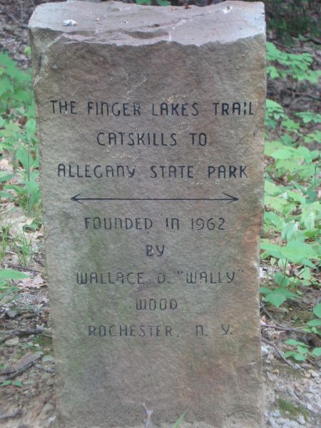
After leaving South River Road, the trail reaches the privately owned "Hesse Lean To" shelter. Hikers are welcomed here as long as the family isn't using the shelter. The trail now passes the Wallace D Wood Stone Memorial. Wally Wood was the first board president of the Finger Lakes Trail Conference. It was his idea to build the Finger Lakes Trail across the state, which was done before the existence of the North Country Trail.
After leaving Pennycook Road at a fence stile, there are some views as you hike along gently rolling terrain. The trail follows more roads for a short time before heading up "Carl Didas Private Drive". From here the trail has more views to the north as you hike in a mixture of woods then fields. Another short road walk before the final nice hike along Keshequa Creek. The trail ascends along the creek for a time before heading away to Old State Road and the end of this section. Look below for some pictures, a detailed description and maps of this section of the NCT.
NCT at Whiskey Bridge and Letchworth Trail JCT
Hesse Lean To (picture courtesy of Kirk Doyle)
Wally Wood Memorial (picture by Kirk Doyle)
Mile Elevation North Country Trail Description (Follow white blazes) 0.0 1101 feet This section begins as the trail crosses the Whiskey Bridge over the Genesee River. Parking available under bridge. GPS N42 33.513 W78 02.869 Cross bridge and veer right along Bailey Road. Entering Livingston County.
0.45 1126 feet Turn right on PRIVATE Hampton Road (around gate).
0.85 1152 feet Take left fork uphill on dirt lane.
1.1 1228 feet Left just prior to "Dead End" sign.
1.4 1361 feet View of Genesee River Valley.
2.5 1403 feet Left on dirt South River Road. Shoulder parking. GPS N42 32.048 W78 02.020
2.7 1397 feet Right off road. Trail follows stream.
2.8 1435 feet Hesse Lean To (Hikers welcome if family is not using). Soon pass Wallace Wood Memorial.
3.4 1515 feet Left on Pennycook Road. Shoulder Parking. GPS N42 32.285 W78 01.404
3.5 1506 feet Right off road at fence stile. Some views.
5.05 1491 feet Trail register. Cross Short Tract Road. Parking. GPS N42 32.482 W78 00.013
5.8 1583 feet Left on Smith Road.
5.95 1596 feet Right on Smith Hill Road.
6.0 1597 feet Quick left up "Carl Didas Private Drive". Follow white blazes. Views ahead to the north.
6.95 1701 feet Highest point along this section of the trail.
7.15 1623 feet Cross Grey Road.
7.7 1388 feet Cross Hunt Hollow Road and follow Cheese Factory Road. Parking. GPS N42 32.211 W77 57.785
8.0 1312 feet Just after bridge over creek, trail turns right off road. Nice walk along Keshequa Creek.
8.7 1473 feet Reach Old State Road (County Road 24) and the end of this section. For a continuation of the NCT see Rattlesnake WMA.
| CNY Hiking HOME PAGE | Finger Lakes Trail | NCT in Western New York | North Country Trail in NY |