Northville - Placid Trail
Blue Mountain
Wild Forest
NY 28/NY 30 to NY 28N
![]()
| CNY Hiking HOME PAGE | Northville-Placid Trail | Hiking in Adirondack Park | Blue Mountain Wild Forest | Adirondack State Campgrounds |
|
Hiking in the Adirondacks Northville - Placid Trail Blue Mountain Wild Forest NY 28/NY 30 to NY 28N
|
|
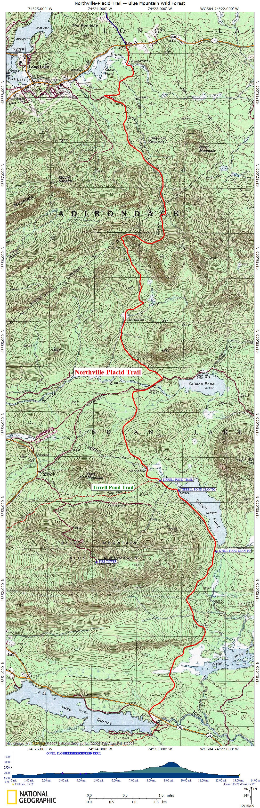
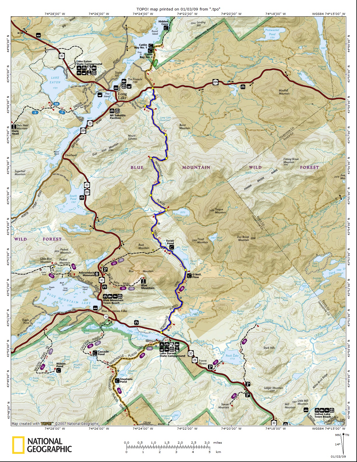
While most of this section of the Northville-Placid Trail is within Blue Mountain Wild Forest, portions of the trail do traverse Finch, Pruyn Company, Inc. lands in the vicinity of O'Neil Flow and Buck Mountain. Once you pass Tirrell Pond, the trail becomes remote and at times, hard to follow with major beaver activity. I have read blogs that talk about hikers being stuck waist deep in muck in some of these flooded sections in this area. Be careful!!!
The start - finish of this section lies along main state roads, making the trailheads very popular and easily accessed. The distance between the two major trailheads, 13+ miles, make this a popular "shuttle" hike; however it's an impossible day hike round trip hike (26+ miles). You will need a shuttle if you plan to hike this section (without retracing your steps back to your vehicle). For those making this a shuttle day hike, give yourself at least eight hours to complete. Be prepared for major beaver flooding that is possible at numerous points along this section.
Tirrell Pond Lean To is a popular weekend gathering place, so be prepared to expect others at this lean to. This section has the hardest ascent on the whole trail as well as the highest point at 3008 feet. There are a few very steep sections of trail that can be expected. You are 92.5 miles from the Northville kiosk.
Check out the NY DEC website at Adirondack Trail Information for updated trail conditions. We recommend that you purchase Northville-Placid Trail (National Geographic Trails Illustrated Map)
to help plan your Northville-Placid Trail adventure.
Mile Elevation Description (NY 28 to NY 28N) 0.0 1804 ft NY 28. Head north on the well worn & marked trail. The hamlet of Blue Mtn Lake is four miles to the west.
0.7 1805 ft Cross a wet section.
2.0 2003 ft An old road comes in on your right.
2.9 1949 ft O'Neil Flow Lean To. Tirrell Pond is on your right.
3.9 1916 ft Tirrell Pond Lean To is off to the right.
4.2 1942 ft Junction of the Tirrell Pond Trail on left leads 3 miles to NY 30.
4.6 1943 ft Wet area. Cross stream.
5.5 2080 ft Entering wet area sometimes effected by beavers.
5.9 2054 ft Reach private dirt road. Turn right and follow dirt road.
6.1 2043 ft Cross Salmon River on bridge.
6.3 2084 ft Trail turns left off dirt road. Start of long ascent to highest point along whole Northville-Placid Trail.
7.0 2221 ft Some views.
7.4 2275 ft Wet area. Cross stream.
9.2 3008 ft Highest point along whole Northville-Placid Trail. Begin sometimes steep descent toward NY 28N.
11.5 1868 ft Old road comes in on your right.
12.0 1803 ft Junction of old road. Trail turns right.
12.4 1761 ft Cross Sandy Creek. Wet area.
12.8 1748 ft Cross Shaw Brook.
13.1 1772 ft Reach NY 28N and end of this section.
| CNY Hiking Home Page | Adirondack Park | Northville-Placid Trail |