New York State Parks
Taconic
![]()
| CNY Hiking HOME PAGE | New York State Parks | Catskill Park |
|
New York State Parks Taconic
|
Taconic State Park is located along 16 miles of the Taconic Mountain Range, sharing a border with Massachusetts and Connecticut. Two developed areas, Copake Falls and Rudd Pond, offer an extensive trail system with terrain that varies from easy to challenging, offering spectacular views.
East of the Harlem Valley of New York and west of the Housatonic Valley of Connecticut and Massachusetts rise the Taconics. They extend north through western Massachusetts and eastern New York into southwestern Vermont, where they reach their highest elevations.
There are plenty of activities for campers, as well as day visitors to enjoy in the oldest State Park in the Taconic Region. Bike or stroll along the newly developed Harlem Valley Rail Trail, hike to Bash Bish Falls, just over the Massachusetts border or up Brace Mountain, the highest point in Dutchess County.
The trail system of the Southern Taconics features two parallel trails running north-south: the 15.6-mile South Taconic Trail following the western range and escarpment, and a 16.5 section of the Appalachian Trail on the eastern range. Other hiking routes consist mostly of side trails ascending to the highland from the valleys on either side. This system provides for circuit hikes, some of which include stretches of unpaved road.
- The highly scenic South Taconic Trail lies mostly in Taconic State Park and Mount Washington State Forest along the western escarpment and range of the southern Taconics. The trail may be divided into two sections that together span 15.6 miles.
- South Taconic Trail, Southern Section [9.4 miles; white] goes from Rudd Pond Farms to NY 344, and includes steep, very rough sections.
- South Taconic Trail, Northern Section [6.2 miles; white] goes from NY 344 to NY 23.
- The route of the Appalachian Trail through the southern Taconics lies entirely within Connecticut and Massachusetts.
- A 3.7-mile segment of the Harlem Valley Rail Trail extends south from the Capoke Falls area.
Here's a few popular hikes located in the park according to the NY-NJ Trail Conference website:
Brace Mountain on the Taconic Ridge (7 miles, moderate to strenuous)
South Taconic Tri-State Hike (11 miles, moderate to strenuous)
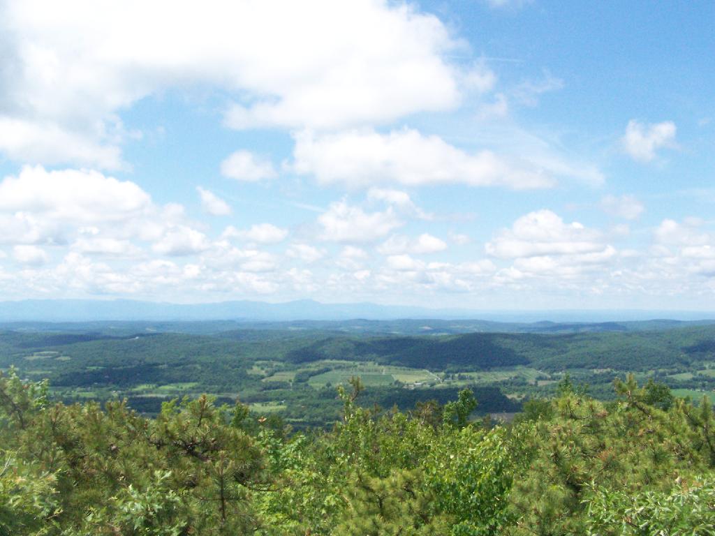
Bash Bish Falls – Sunset Rock – Prospect Hill via the northern section of the South Taconic Trail (8.1 miles)
Directions: To reach Taconic State Park, take Taconic Parkway, exit at Claverack-Hillsdale Exit. Take NY 23 east for 8 miles into Hillsdale. Turn right onto NY 22 south and go 4 miles to Copake Falls. Turn left onto NY 344 east. Park entrance will be ½ mile on the left.
How do I get to Taconic State Park?
View from Sunset Rock (Courtesy of AndyArthur.org)
| CNY Hiking HOME PAGE | New York State Parks | Catskill Park |