Oswego County Recreational Trail
Eastern Section
![]()
| CNY Hiking HOME PAGE | Hiking in Oswego County | Western Section of OCRT | Oswego County Recreational Trail |
|
Hiking in Oswego County Oswego County Recreational Trail Eastern Section
|
Below you'll find maps and descriptions of the eastern section of the Oswego Country Recreational Trail.

| Mile | Above map Trail Description (Central Square to Constantia) |
| 0.0 |
Oswego County Route 37 Trailhead. Head east along old railroad bed. |
| 1.7 |
Cross Toad Harbor Road. |
| 2.4 |
Cross Depot Road. |
| 3.25 |
Cross Wheeler Road |
| 3.65 |
Cross Lower Road |
| 5.5 |
Cross NY 49 |
| 6.2 |
Cross Redfield Street in Constantia. |
| 6.3 |
Cross Oswego County Route 23. For a continuation, see the map below. |
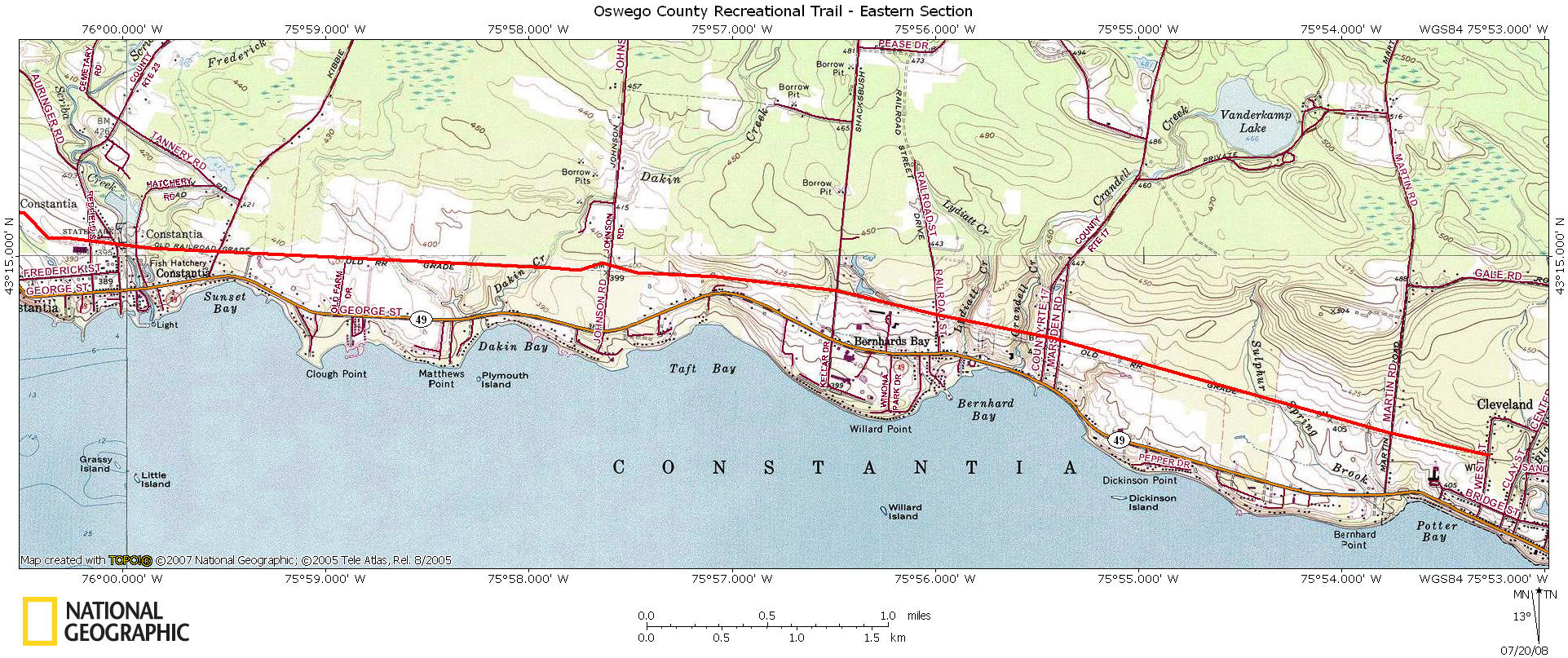
| Mile | Above map Trail Description (Constantia to Cleveland) |
| 6.3 |
Cross Oswego County Route 23. Soon cross Scriba Creek. |
| 6.4 |
Cross Hatchery Road |
| 6.7 |
Cross Kibbie Lake Road. |
| 8.35 |
Cross Johnson Road. |
| 9.3 |
Cross Shackbush Road |
| 9.7 |
Cross Railroad Street |
| 10.2 |
Cross Oswego County Route 17 |
| 10.25 |
Cross Marsden Road |
| 11.7 |
Cross Martin Road |
| 12.1 |
Reach West Street and entering Village of Cleveland, NY. |
| CNY Hiking HOME PAGE | Oswego County Recreational Trail | Western Section of OCRT |