Finger Lakes National Forest
Burnt Hill Trail
![]()
| CNY Hiking HOME PAGE | Finger Lakes National Forest | FLT/NCT in FLNF | Interloken Trail | No-Tan-Takto Trail |
| Gorge Trail | Southslope Trail | Potomac Trail | Ravine Trail | Backbone Trail |
|
Finger Lakes National Forest Burnt Hill Trail
|
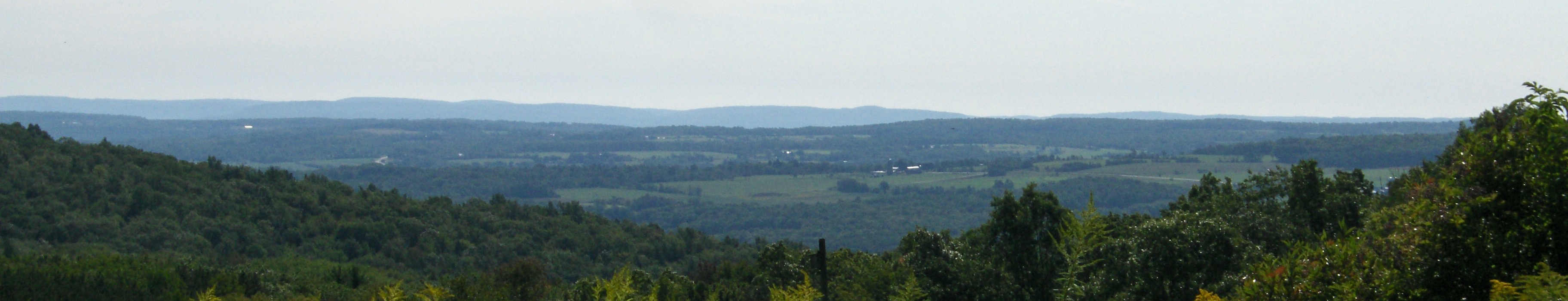
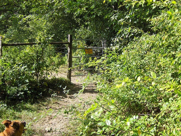
The 2.3 mile Burnt Hill Trail is located on the southern section of Finger Lakes National Forest, extending south from Picnic Area Road, near Blueberry Campground. It crosses shrub-lands and pastures, and offers beautiful vistas along the way. It is a primitive trail with a natural tread. It has gravel in wet areas and is mowed through the fenced pastures. Please close gates behind you when you are entering/leaving a pasture. The trail intersects with the Interloken Trail and the Backbone Trail.
A great 3.8 mile loop can be created utilizing the Burnt Hill Trail and the Interloken Trail called the "Burnt Hill Loop".
Trail Facts
Length: 2.3 miles one way
Max. Elevation Change: 139 feet
Amount of use: Moderate
Feature: Views & cow pasture
Hiking level: Easy
Use restrictions: No motorized vehicles except snowmobiles when conditions permit.Caution: Be aware Horses, Hikers, Mountain Bikers, Skiers and Snowmobilers use this trail in season. Trails are closed to horse users from March 15th thru May 1st due to muddy conditions.
Entering a pasture thru a gate on the Burnt Hill Trail
Directions
From the South: take NY 17 (I-86 in some areas) to exit 52 (Watkins Glen exit/NY 14 North). In Watkins Glen, turn right on NY 414 North, at the Fourth St. intersection go approximately 9 miles north, past the Hector Ranger Station of the Finger Lakes National Forest on the right. The next asphalt road ½ mile past this on the right is Schuyler County Route 2. Turn right and go 4.1 miles east past County Route 4 to the View Point parking area (just east of the Blueberry Patch Campground). The trail is located on the south side of the road. GPS N42 29.069 W76 47.790
From the North: take I-90 to exit 41 (NY 414 south to Hector, NY) the second asphalt road on the left past Wickham’s Plaza (1/2 mile) is County Route 2, turn left and go 4.1 miles east past County Route 4 to the View Point parking area (just east of the Blueberry Patch Campground). The trail is located on the south side of the road. GPS N42 29.069 W76 47.790
You can also use the larger day use parking area at the Blueberry Campground, just west of the View Point Parking Area.

| CNY Hiking Home Page | Finger Lakes National Forest | Finger Lakes Trail |