Kennedy State Forest
Finger Lakes Trail System
Virgil Mountain
Loop
![]()
| CNY Hiking HOME PAGE | Hiking in Cortland County | FLT/NCT in Kennedy State Forest | Dabes Diversion Loops | Kennedy State Forest |
|
Hiking in Cortland County Kennedy State Forest Finger Lakes Trail System Virgil Mountain Loop
|
This 4.7 mile loop hike takes you past the Greek Peak Ski resort and to the highest point in Cortland County on Virgil Mountain (2132 feet). There are also some views along the way. This is one of the more popular loop hikes in Central New York. The creek crossing just south of the parking area can be tricky/dangerous in high water times.
This hike is particularly popular during the fall when the leaves are in peak color. Take a drive to Virgil, NY and enjoy this great hike. There is an overall elevation gain/loss of over 800 feet on this moderate hike, making it more challenging than other hikes.
We have a map, a few pictures and detailed description of this hike below. This hike is featured in the book Take A Hike - Family Walks in New York's Finger Lakes Region
.
DIRECTIONS - From Virgil take NY 392 EAST and then a left on Van Donsel Road. Take your second right onto O'Dell Road. At the corner of O'Dell Rd and Baldwin Rd there is a small parking area on the left. Park here. The GPS coordinates of the parking area is N42 29.232 W76 09.672 for those who have a GPS devise in their vehicle.
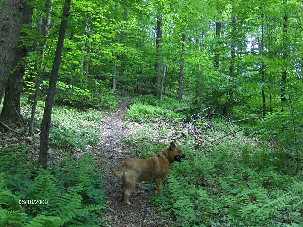
Finger Lakes Trail / North Country Trail near Greek Peak
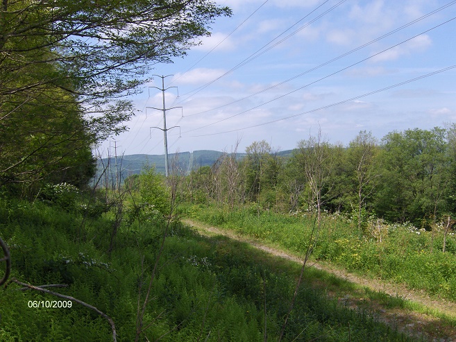
The power lines near Virgil Mountain along the FLT/NCT
Mile Elevation Description 0.0 1706 feet Parking area on the corner of Baldwin Rd & O'Dell Rd. Head north on O'Dell Rd (back where you just drove down).
0.2 1767 feet Turn right off road on trail. Follow white blazes. Entering Kennedy State Forest. You are now on the Finger Lakes Trail / North Country Trail.
1.1 1983 feet Cross Van Donsel Road.
1.2 2098 feet Greek Peak
2.0 2132 feet Virgil Mountain and the highest point in Cortland County.
2.1 2079 feet Reach National Grid High Power Lines. Turn right and follow power lines. Views.
2.3 2039 feet Junction of Virgil Mountain Loop Trail (orange blazes). The FLT/NCT veers left toward Tone Rd. Stay straight on the Virgil Mountain Loop Trail (following power lines) and follow orange blazes.
2.6 1984 feet Cross seasonal dirt road.
2.8 1932 feet Trail veers right away from power lines. Follow orange blazes into woods.
3.1 2075 feet Reach a highpoint.
3.3 1999 feet Cross a seasonal dirt road.
3.5 2059 feet Start of a long descent on an old woods road.
4.2 1675 feet Reach the junction of the Dabes Diversion Trail (straight) and the Finger Lakes Trail/North Country Trail (left-right). Turn right on the Finger Lakes Trail/North Country Trail and follow the white blazes.
4.6 1689 feet Reach O'Dell Rd and turn right following dirt road.
4.7 1706 feet Parking Area and the end of the Virgil Mountain Loop.

| CNY Hiking HOME PAGE | Finger Lakes Trail | Lithuanian Loop Trail |
| Kennedy State Forest | Dabes Diversion Loops | Swedish Loop Trail |
| Irvin Loop | Spanish Loop | FLT/NCT in Kennedy State Forest |