in Massachusetts
US 20 to
Mass 9
Finerty Pond
![]()
| CNY Hiking HOME PAGE | Appalachian Trail | AT in Massachusetts | AT - Sages Ravine |
| AT - East Mountain | AT - Upper Goose Pond | AT - Mount Greylock | AT in Vermont |
|
Appalachian Trail in Massachusetts US 20 to Mass 9 Finerty Pond
|
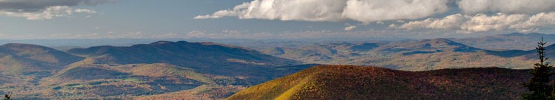
The Appalachian Trail travels 90 miles in Massachusetts as the trail winds through the Berkshires. The trail passes over the highest point in the state at Mount Greylock with an elevation of 3491 feet. The trail travels over hills, valleys and through towns and hamlets of the Berkshires. The AT passes through the towns of Dalton and Cheshire.
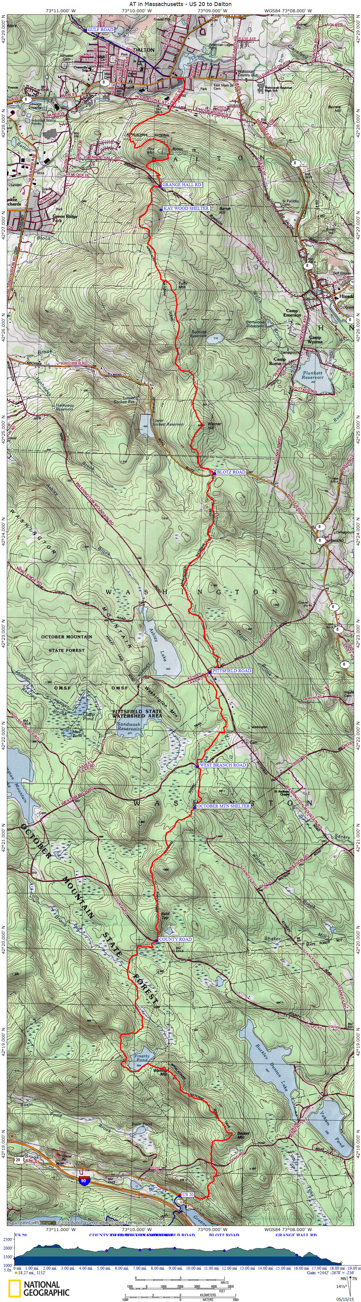
This 19.0 mile stretch of the Appalachian Trail in Massachusetts starts as the AT crosses US 20, heading north and features Becket Mountain, Finerty Pond and Bald Top. This section of the AT includes the October Mountain Shelter and Kay Wood Shelter. This section of the AT ends in Dalton, Massachusetts at the junction of Mass 8 and Mass 9. This is a popular resupply town for thru hikers.
Use the links above to explore different sections of the AT in Massachusetts. Look below for a detailed description of key points along the trail within this section. There are maps below as well.
Appalachian Trail GPS Tracks Get the complete GPS Tracks for the AT in Massachusetts for ONLY $1.97! This .gpx file includes waypoints for all trail shelters along the trail in Massachusetts and many of the official AT parking areas. Use the BUY NOW button below and we'll send you the file via e-mail! Happy Hiking!
Appalachian Trail Hiking Guide
Massachusetts
....coming soon
Miles from Springer Mtn Elevation Key points along the Appalachian Trail in Massachusetts 1546.8 1400 feet US 20 (Lee, MA 01238) 1547.6 1750 feet Tyne Road 1548.1 2180 feet Beckett Mountain 1549.9 1900 feet Finerty Pond 1552.2 1850 feet County Road 1552.4 2040 feet Bald Top 1554.0 1930 feet October Mountain Shelter 1554.7 1960 feet West Branch Road 1556.2 2000 feet Washington Mountain Road, Pittsfield Road (Becket, MA 01223) 1558.2 1950 feet Stream 1559.4 1850 feet Blotz Road 1560.1 2050 feet Warner Road 1562.8 1860 feet Kay Wood Shelter 1563.1 1650 feet Grange Hall Road 1565.2 1199 feet CSX Railroad 1565.8 1200 feet MASS 8, MASS 9 (Dalton, MA 01226)
| CNY Hiking HOME PAGE | Appalachian Trail |
